
|
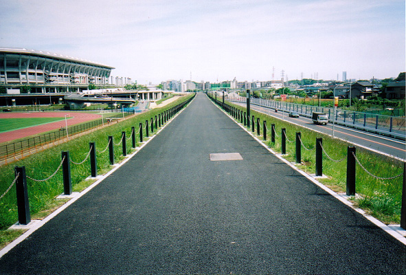
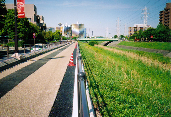
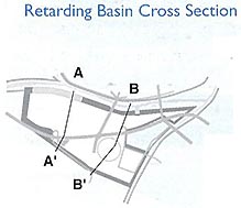
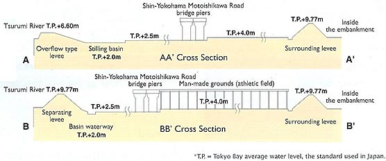
| A retarding basin is a flood control device used to temporarily collect a portion of the water that accumulates during a flood to reduce downstream flooding. To improve its water collection (retarding) functions, the basin is surrounded by embankments and excavated deeper than the surrounding area. Then, some of the embankments are built to allow overflow from the river to flow into the basin. The entire system is comprised of a Surrounding levee, Separating levee, overflow embankment, land that can slow down the river water, and a Sewage gate. During normal times, the area can be used for multiple purposes, as a park or recreation area. |
 |
| Two types of embankments are installed around the retarding basin. The Surrounding levee is located between the retarding basin and the neighboring lands, while the Separating levee is located between the retarding basin and the river. |
 |
 |
| Surrounding levee |
Right: Separating levee |
|
|
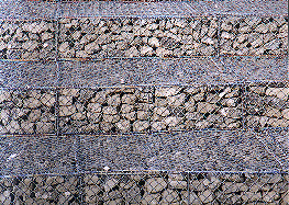 |
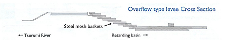
| Steel mesh baskets |
 |
| Overflow type levee that utilizes steel-mat construction |
|
 The Overflow type levee is a portion of the Separating levee that is built slightly lower than the rest of the embankment to allow water to flow into the retarding basin during a flood. The force of the flow of water from the Overflow type levee is reduced by the Stilling basin, and the water collects in the ground in the basin. The Overflow type levee is constructed with steel mesh baskets to facilitate maintenance, to allow it to fit in with the surrounding scenery, and to fulfill environmental considerations.
|
 |
|
|
|
|
 |
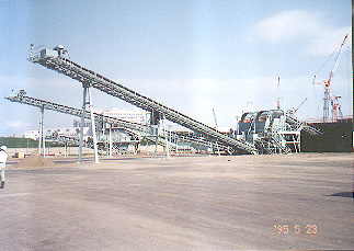
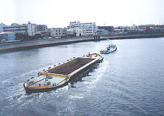
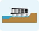
| The land excavated from the retarding basin contained construction debris, large rocks, and concrete. A trommel (a device used to separate and crush soil) was used to remove these items from the soil. It separates out these items and crushes anything with a diameter larger than 150mm. When transporting the soil to Minami-honmoku, we wanted to avoid transporting it through the city due to considerations of traffic congestion and the environment. A dump truck and soil transport barge on the river were used instead. |
 |
 |
| Trommel |
Soil transport barge |
|
|
|
 |
 |
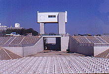
The International Stadium Yokohama was also built using piling construction. |
|
| According to available statistics, the area north of Shin-Yokohama Motoishikawa Road where the ground level is T.P. + 2.50 m floods once every one or two years, and the area south of that line where the ground level is T.P. + 4.00 m floods once every four or five years. |
A |
|
| A |
The current flood control plan stipulates an overflow type levee length of 777 m. This is designed to safely discharge an amount of water that would occur in a flood of a magnitude seen only once every 150 years. With this level of rainfall, the average rainfall in the basin would be 178 mm in four hours, and 405 mm over two days. Currently, we are in the process of extending the length of the provisional overflow type levee to 450 m. This is the length deemed necessary for safely discharging the same magnitude of flooding that occurred during the Kanogawa Typhoon of September 1958, the largest flood in the postwar period. This level of rainfall has a probability of occurring once every ten years. The actual average rainfall in the basin in this case was 109 mm in four hours, and 353 mm after two days. |
|
 |
|

