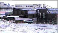
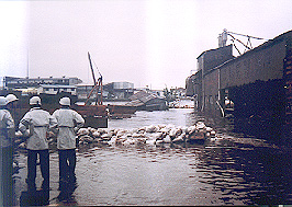
Flood of September 1982
|
| Flood date
| Average two-day rainfall in the basin (mm) |
Water level (Sueyoshi Bridge) T.P. (m) |
Peak flow rate (Sueyoshi Bridge)
(m3/s)
|
Comments |
Above ground flooding (buildings) |
Under ground flooding (buildings) |
09/26/58
Kanogawa
Typhoon
|
352.7 |
3.76 |
509 |
Flooding throughout the basin |
16,991 |
48,766 |
06/28/66
Typoon No.4
|
310.2 |
3.94 |
503 |
Flooding throughout the basin |
15,422 |
51,741 |
09/09/76
Typoon No.17
|
142 |
3.51 |
693 |
Flooding throughout the basin |
1,343 |
3,481 |
10/22/81
Typoon No.24
|
180.1 |
3.49 |
755 |
Flooding in areas without embankments |
28 |
396 |
09/12/82
Typoon No.18
|
218 |
4.02 |
1,051 |
Flooding in areas without embankments |
1,491 |
4,056 |
09/18/91
Typoon No.18
|
287.2 |
2.85 |
1,021 |
Inner water |
59 |
52 |
08/20/94
Heavy rain front
|
206.8 |
2.03 |
- |
Inner water |
- |
11 |
09/21/96
Heavy rain front
|
195.9 |
1.94 |
884 |
Inner water |
- |
- |
|
|
|
The increase in floodwater flows that has accompanied rapid urbanization in this area is very difficult to contain through river improvements alone. Various measures are thus being taken to improve the water retention and retarding functions that allow rainfall to accumulate in and be absorbed by the river basin, and to develop communities that are highly resistant to flood damage. The Comprehensive Flood Control Measures represent an effort to deal with the river and the river basin as an integrated whole. The multipurpose retarding basin project is one of these efforts, and is being promoted as a major pillar of the river improvement project. To carry out the work that will make it possible for people to live safely in this area, the understanding and cooperation of each and every river basin resident is necessary. |
Flood of September 1982
|
|
| Jan 1985 |
 |
Efforts to acquire land begin. |
| May 1889 |
Tsurumi River New River Basin Improvement Plan is formulated. (Sets the basic high water flow rate at Sueyoshi Bridge at 1,300 m3/s, and the planned high water flow rate at 1,050 m3/s.) |
| Jan 1993 |
Urban plan is decided (retarding basin, site parks, and urban planned roads). |
| Mar 1993 |
Parks projects are approved under the City Park Law. |
| Jan 1994 |
Groundbreaking ceremony (January 17). Site excavation works begins. |
| June 1994 |
Basic construction plan is revised. (Sets the basic high water flow rate at Sueyoshi Bridge at 2,600 m3/s, and the planned high water flow rate at 1,800 m3/s.) |
| Feb 1996 |
Construction on retarding basin perimeter embankment begins. |
| Mar 1996 |
Replacement work begins on supplemental roads (the Shin-Yokohama Motoishikawa Road and others). |
| Oct 1997 |
The International Stadium Yokohama is completed (work began Jan. 1994). |
| Oct 1998 |
Kanagawa National Sports Festival is held. |
| Mar 1999 |
Construction on Sawage gate begins. |
| Mar 2001 |
Construction on overflow type levee begins. |
| Mar 2002 |
Joint use of supplemental facilities (urban planned roads (Shin-Yokohama Motoishikawa Road and Ikuta Road)) begins. |
| Mar 2003 |
Use of Tsurumi River Multipurpose Retarding Basin scheduled to begin. |
|
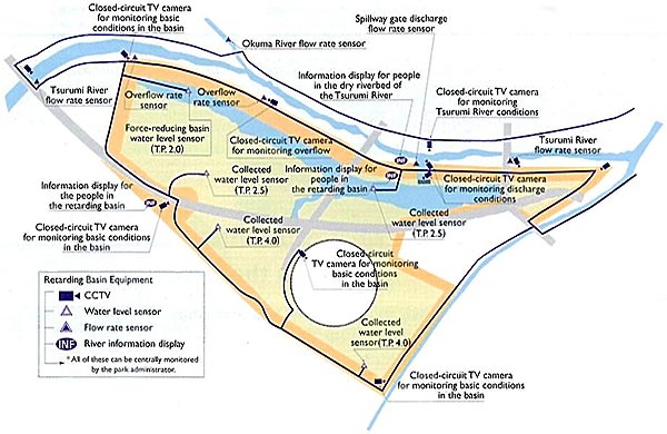
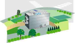
| Location: Kozukue-cho and Toriyama-cho in Kohoku-ku, Yokohama |
| Retarding basin area: 84 ha |
| Flood regulation volume: |
(Provisional channel) Retarding basin alone - 200 m3/s
(Planned channel) Retarding basin and improved water channel 700 m3/s
|
|
| Total water storage capacity: 3,900,000m3 |
| Planned high water level: T.P. + 8.573 m |
| Land use: Multipurpose use (e.g., parks) |
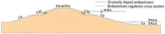
Ground height in basin
North of Shin-Motoishikawa Road: T.P. + 2.5 m
South of Shin- Motoishikawa Road: T.P. + 4.0 m
|
Overflow type levee
Structure: Sides - steel mesh baskets, Top - asphalt facing
Height: T.P. + 6.6 m
Length:provisional 450 m planned 777 m
|
Separating levee
Height: T.P. + 9.773 m
Length:provisional 1,830 m planned 1,500 m
|
Surrounding levee Height: T.P. + 9.773 m
Length:provisional 2,260 m
|
Sewage gate
Location sTsurumi River right bank 13.6 km + 70 m
Height T.P. + 2.0 m
Normal drainage (conduit) B=1.8m ~ H=1.00m (slide gate)
Flood drainage (spillway) B=10.0m ~ H=7.77m (roller-type steel gate)
|
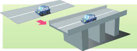
Supplemental facilities (roads)
Shin-Yokohama Motoishikawa Road: Elevated portion: B=32.0m L=728m
On-ground portion: B=32.0m L=975mIkuta Road:
Elevated portion: B=12.0m L=379m
On-ground portion: B=12.0m L=600m
Yokohama City Road No. 1 and 2: B=16.0m L=265m (140m, 125m)
|
|
|